


Precision Drone Data for Unique Business Insights

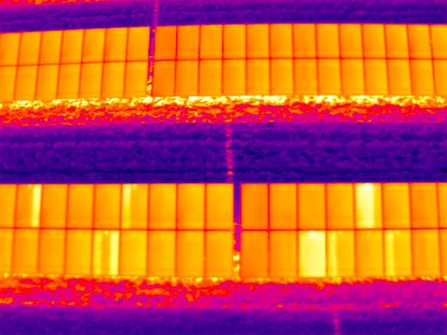
SkySurveyUSA delivers precision drone services for the construction industry in New York and surrounding counties like Westchester, Nassau, and Suffolk. Our nationwide network of FAA-certified pilots provides aggregate volume measurements, precision mapping, 3D modeling, and thermal inspections. From tracking construction progress in Manhattan to conducting aerial safety inspections for multi-resident communities, our drones deliver accurate data and actionable insights. Enhance project efficiency with our advanced analytics and volumetrics. Visit our homepage or explore our store to learn more about our solutions.