

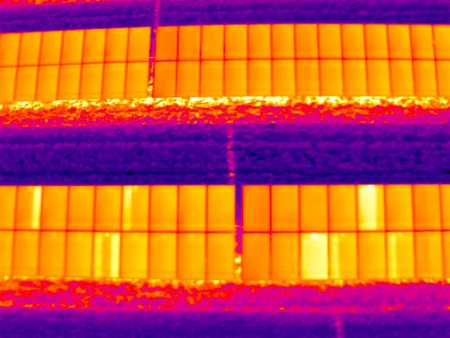

Precision Drone Data for Unique Business Insights

In Buffalo and surrounding Erie and Niagara Counties, SkySurveyUSA offers specialized drone services for construction and industrial projects. Our services include precision mapping, 3D modeling, aggregate volumetrics, and thermal inspections for multi-resident communities. Whether monitoring construction sites or analyzing data for safety compliance, our nationwide pilot network ensures high-quality results. Optimize your project with our cutting-edge drone technology. Check out our homepage or visit our store for more details.