


Precision Drone Data for Unique Business Insights

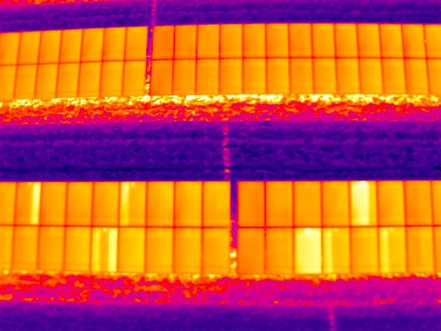
SkySurveyUSA brings precision drone services to Cleveland and surrounding Cuyahoga and Lake Counties, focusing on construction and industrial needs. Our offerings include aggregate volume measurements, 3D modeling, precision mapping, and thermal inspections for multi-resident communities. From construction progress tracking to safety inspections, our nationwide pilots deliver reliable data. Discover how we can streamline your project on our homepage or store.